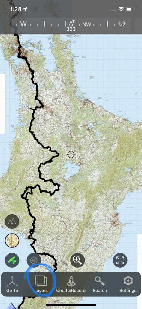
Data layers
Data layers are additional sets of waypoints, tracks, and boundaries that can be downloaded and added to the map. Tap the update button at the bottom of the Layer window to check for updates and additional layers.
Individual layers first need to be installed by tapping the install button, and can then be turned on and off using the show/hide button. The update button will show if further updates to the layer are available. The delete button will delete the layer from your phone.
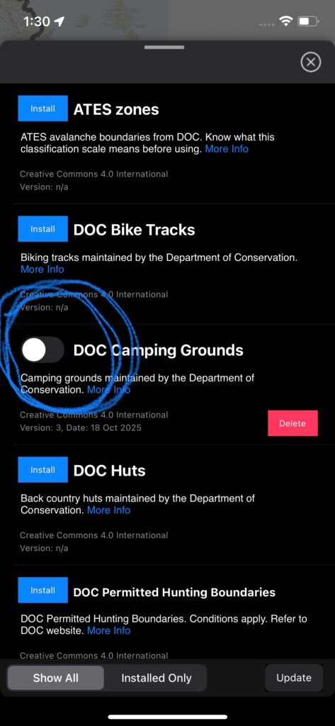
Layers can be from a range of different sources not owned or managed by Rightplace Resources ltd, and the data for some layers may be hosted by third parties. Check the licence conditions before use. Further information on some individual layers is listed below. Check the info link in the app for details on individual layers.
DOC tracks, huts, roads, camping, biking, public land including national parks, reserves, etc
This information is sourced from the NZ Department of Conservation and Land Information New Zealand, under the Creative Commons 4.0 licence. Accuracy is not guaranteed and the presence or absence of any map features does not indicate right or practicality of access.
DOC hunting boundaries
DOC hunting boundaries are managed by permit. Check that your permit conditions are consistent with the information provided in this layer before use. Open permit boundaries are sourced from DOC servers that are understood to be kept up to date. Restricted permit boundary updates are not currently being made available for use in the app, and these boundaries are subject to frequent change, so use the restricted permit boundaries with caution.
Te Araroa
Te Araroa trail data is retrieved from data sets provided here: https://www.teararoa.org.nz/trail-maps/. This data is updated periodically. Check the website for any recent changes or track updates.
Open Street Map data
This data comes from Open Street Map. Tracks and roads may include ones that are private and/or inaccessible.
Mountain biking trails were collated using this filter:
way[“highway”=”cycleway”][“surface”=”dirt”](area.nz);
way[“highway”=”cycleway”][“surface”=”gravel”](area.nz);
way[“bicycle”=”designated”][“highway”=”track”](area.nz);
way[“bicycle”=”designated”][“highway”=”path”](area.nz);
way[“bicycle”=”yes”][“highway”=”track”](area.nz);
way[“bicycle”=”yes”][“highway”=”path”][“surface”!=”asphalt”][“surface”!=”paved”][“surface”!=”concrete”][“surface”!=”paving_stones”](area.nz);
4WD tracks were collated with this filter:
Airspace boundaries
Airspace boundaries were converted from OpenAir format files from OpenAIP.net. Segments between WGS84 coordinates are retained as straight lines when converted to the NZTM projection so deviations of up to 0.1% might exist between vertices. The position of vertices themselves should be accurate. Please check official airspace charts for accuracy and/or changes. The data is licensed for personal use only.